
Visit the Seven Most Stunning Parks in London
London is a city of contrasts, with a fast-paced lifestyle and busy streets. Nevertheless, it is also home to some of the most beautiful parks and green spaces in the world. These parks offer a peaceful and serene escape from
What’s happening in London in April
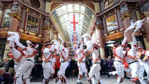
What’s happening in London in April Every April, London buzzes with energy and vibrancy as the city offers a vast array of events that take place every year. With such a plethora of options of what’s happening in London in
18 of Best Views in London You Don’t Want to Miss
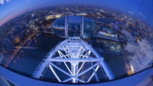
18 of Best Views in London You Don’t Want to Miss Want to know where to find the best views in London? London is a city that never fails to impress. London is a city full of filled with extraordinary

London’s Best Indian Restaurants: 9 Fantastic Experiences
London’s Best Food: 9 Fantastic Indian Restaurants Look no further for London’s best Indian restaurants. London is a cultural melting pot and is home to a vibrant and diverse food scene. Amongst the numerous cuisines readily available, Indian cuisine stands apart

Best Day Trips Out of London
Best Day Trips out of London London, with its bustling city life and iconic landmarks, is a destination that attracts millions of visitors each year. Indeed, there is so much to do and see in London that its almost impossible

What’s happening in London in July
What’s happening in London in July What’s happening in London in July is a feast of unique experiences and plethora of activities, festivals, and events that make July in the city a truly vibrant experience. From outdoor extravaganzas to cultural celebrations,

Hotel Profile Zedwell Piccadilly: Affordable minimalism is an oasis of tranquility
Nestled in the bustling heart of London, Zedwell Piccadilly Circus offers a peaceful sanctuary amidst in the middle of the vibrant energy of the city. With its prime location, exceptional amenities and innovative style, this urban retreat guarantees a truly unique and memorable
Top 10 Hotels Near Big Ben in London
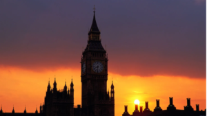
The Top 10 Hotels near Big Ben, London Big Ben is situated in the heart of Westminster, in the centre of London. This iconic landmark – technically the Elizabeth Tower and the huge bell inside called Big Ben – is